Introduction
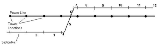
ACPT/ACPTGIS uses bearing angles and extends the reference line(s) to come up the intersecting angles with other facilities such as powerlines (blue) and other pipelines (red). There is a difference in the way Google Earth and ESRI ArcGIS calculates especially when the lines cross each other. If this occurs, a negative sign may be required for the distance(s) to indicate that the reference line crossed to the other side of another powerline or another pipeline. It should be noted that the ACPT calculates these section angles and distances automatically as shown in Figure 1 and Table 1 below.
PRCI ACTB
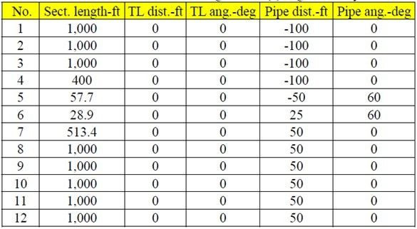
This is based on the way the angles intersect in relation layout of the pipe itself. It makes it more difficult to track layout of the pipeline in relationship to the powerlines. See Figure 2 and Table 1 below. Note these angles and pipe distances must be manually measured in the field or on a map.